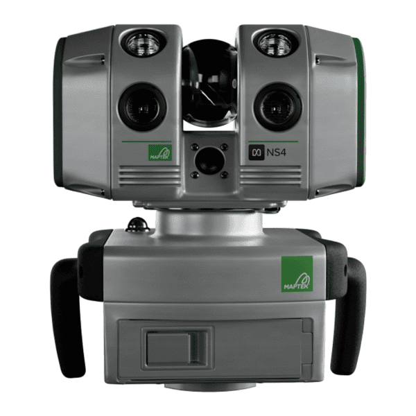
Maptek Laser Scanner NS4

Compact, Connected Survey-Grade Scanning

Portable laser scanner for underground, surface, tunnelling, and civil survey workflows. NS4 combines accurate long-range scanning, panoramic imagery, onboard illumination, and mobile-device operation in a lightweight system.

  • Buil for collaborative surface, underground and civil workflows
  • Use for fast deployment and flexible capture
  • Delivers connected outputs for review and analysis
Range: 1,000 m
Weight: 4.3 kg
Accuracy: 4 mm
Repeatability: ±4 mm
Vertical scanning extent: 260°
Scanning range (horizontal): 360°
Data acquisition rate: 100 · 200 · 400 · 800 kHz

Capabilities
  • Panoramic camera support
  • Vehicle mounted operation
  • On board illumination to 4000 lumens

Download Brochure

Categories: ,

Description

Features, Benefits, and Applications

Key Features
  • Suited for underground, surface, tunnelling and civil survey applications
  • Long-range measurement with survey-grade data capture
  • High-resolution imagery and positional tracking for richer field context
  • Integrates with Maptek workflows for review, modelling and analysis
  • Supports more connected delivery of field data across teams
Benefits
  • Compact and portable for efficient movement between scanning locations
  • Wide 360 × 260° acquisition field of view for faster capture in complex environments
  • Built-in LED illumination for underground, tunnelling and low-light workflows
  • Mobile-device operation for more flexible field control
  • Connected workflows that support faster handoff to office teams
Common Applications
  • Underground stopes and drives
  • Internal and external stockpile volumes
  • Geological mapping
  • Geotechnical and kinematic analysis
  • Stability monitoring and rockfall analysis
  • Pre- and post-blast analysis
  • Open pit, topographic and civil projects
  • Tunnelling projects
  • BIM and digital twins
  • Engineering review and project documentation
  • Forensics and monitoring applications